Grid to list the topographical surfaces loaded in the site. The colour of each surface can be set by clicking the Colour cell
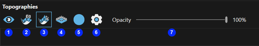
| Icon | Description | |
|---|---|---|
| 1 | Topographies visibility | Toggle visibility of all topographical surfaces. |
| 2 | Image visibility |
Toggle visibility of any loaded aerial images. |
| 3 | Topography gloss |
Toggle application of gloss highlight to the topographical surface. |
| 4 | Mined out surface visibility | Toggle visibility of mined out surfaces. |
| 5 | Key edges | Toggle visibility of topographic surface key edges. |
| 6 | Visualisation settings | Opens the Topography Visualisation Settings dialog. |
| 7 | Opacity | Adjusts the opacity of topography and aerial image overlays. |
Search - Search box (right hand side of tab) to filter the grid rows on, applies fuzzy text search across all fields in the grid.
The key edges and mined out surface rendering is adjusted with this control.
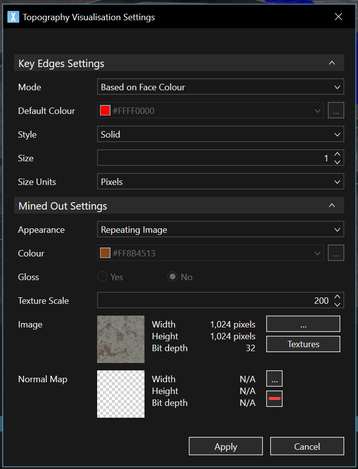
| Field | Description |
|---|---|
| Mode |
The colour of the key edges:
|
| Default Colour | Active when Mode property is set to Custom. |
| Style | The style applied to the key edges, defaults to Solid. |
| Size | The thickness of the key edges, defaults to 1. |
| Size Units |
The size unit to apply to the Size property, defaults to Pixels.
|
| Appearance |
The display style for Mined Out Area faces.
|
| Colour | Colour of mined out face, active if Appearance is set to Solid Colour. |
| Gloss | Toggle Gloss effect when Appearance is set to Solid Colour. |
| Texture Scale | The scale applied to image textures, 100 = native image scale. Defaults to 200. |
| Image | Preview of the applied image. Click the ... button to load a custom image or click Textures to use system images. |
| Normal Map | User-loaded normal map file to customise surface highlights. |